In 2017, researchers from the University of Edinburgh made a groundbreaking discovery of 91 previously unknown volcanoes buried beneath the ice sheet of West Antarctica, unveiling what is now one of Earth’s largest volcanic systems with a total of 138 volcanic formations.
Key Takeaways
- Antarctica is now recognized as Earth’s most densely packed volcanic region, with 138 confirmed volcanoes—exceeding the volcanic concentration found in both the East African Rift and the Himalayas combined.
- Advanced ice-penetrating radar technology exposed this massive subglacial volcanic province, located beneath ice up to 4 kilometers thick. Some individual volcanoes reach altitudes as high as 4,000 meters.
- The volcanic activity may influence ice sheet stability through geothermal heat, which could accelerate ice loss and result in a more significant contribution to global sea level rise than previously projected.
- Melting ice due to climate change may reduce pressure on these volcanoes, potentially triggering more eruptions—a situation that could create a hazardous feedback loop increasing both volcanic activity and melting.
- This discovery underscores how much of Earth’s geology remains hidden and emphasizes the importance of updating climate prediction models to include the effects of volcanic heat beneath Antarctic ice.
These findings not only transform our understanding of Antarctic geology but also raise urgent questions about the stability of the ice sheet and the broader implications for global climate systems. Integrating this new data into climate models is vital for accurately projecting future environmental changes and preparing for their global impact.
Massive Underground Volcanic Province Rivals Earth’s Largest Systems
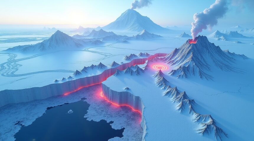
West Antarctica has emerged as one of Earth’s most impressive volcanic frontiers, hiding a massive underground system that rivals any other volcanic province on the planet. In 2017, researchers from the University of Edinburgh made a groundbreaking discovery that fundamentally changed our understanding of Antarctic geology. They identified 91 previously unknown volcanoes buried beneath the West Antarctic ice sheet, dramatically expanding the known volcanic landscape of this frozen continent.
These newly discovered peaks join 47 already identified volcanoes, bringing the total count to an astounding 138 volcanic formations in this single region. The scale of these hidden giants becomes even more remarkable when considering their individual dimensions. The largest subglacial volcano reaches an impressive height of 3,970 meters, nearly matching the stature of Switzerland’s famous Eiger mountain peak.
A Continental-Scale Volcanic Network
The West Antarctic Rift system stretches approximately 3,600 kilometers (2,250 miles) across the continent, covering a distance comparable to traveling from Canada to Mexico. This massive volcanic province demonstrates nature’s ability to create geological wonders on a truly continental scale, even in Earth’s most remote and inhospitable regions.
What makes this discovery particularly significant is the sheer concentration of volcanic activity. Antarctica now holds the record for the most densely packed volcanic region on our planet, surpassing even well-known volcanic hotspots. This subglacial mega-volcanic province contains more volcanoes than the East African Rift and the Himalayas combined, establishing Antarctica as a major player in global volcanic activity.
Scientists believe these hidden volcanoes formed as part of the West Antarctic Rift system, where tectonic forces have been pulling the continent apart for millions of years. The thick ice sheet above has effectively concealed this volcanic province from direct observation, requiring advanced radar and seismic techniques to map its true extent. Many of these peaks remain dormant beneath kilometers of ice, though their potential for future activity continues to intrigue researchers studying Earth’s hidden geological features.
This discovery has profound implications for understanding both Antarctic geology and global volcanic systems. The presence of such an extensive volcanic network beneath the ice sheet raises important questions about heat flow, ice stability, and potential environmental impacts should these systems become more active in the future.
Breakthrough Technology Reveals Hidden Volcanic Landscape
Modern scientific instruments have unveiled one of Earth’s most remarkable geological secrets beneath Antarctica’s ice sheets. I’ve examined how cutting-edge technologies made this extraordinary discovery possible, revealing a massive volcanic system that remained hidden for millennia.
Revolutionary Detection Methods
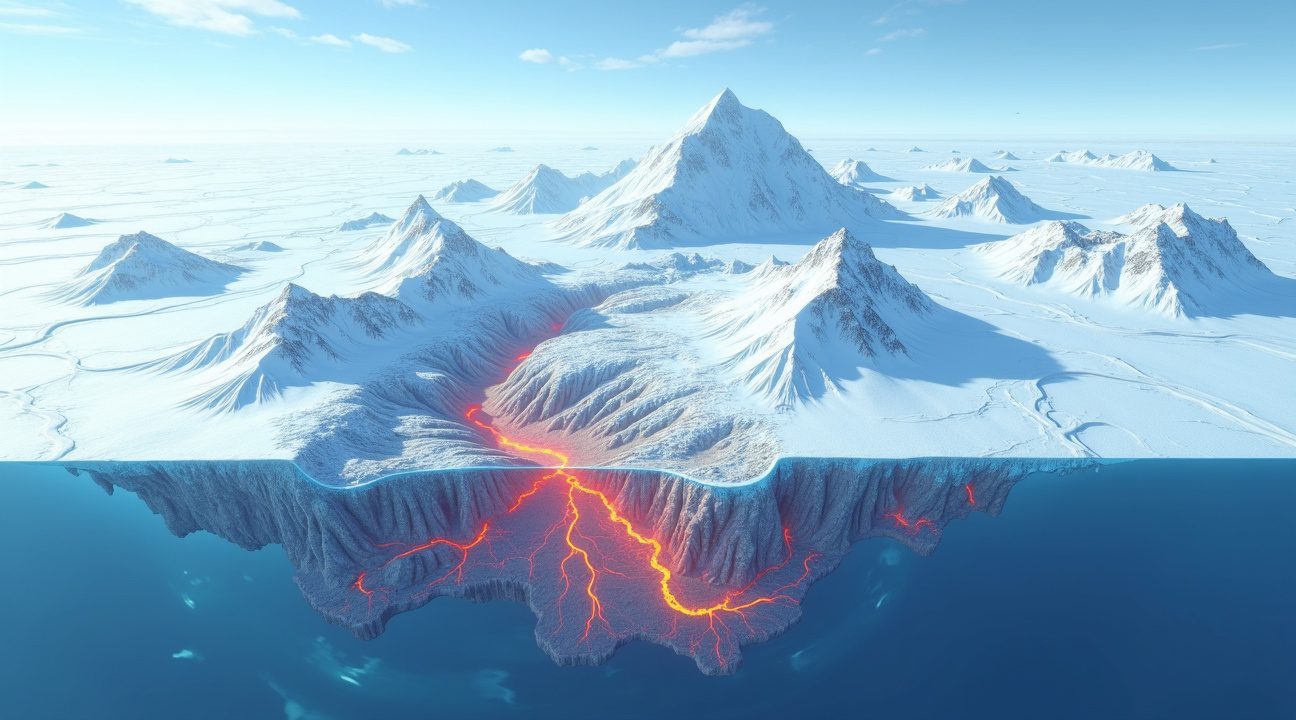
Ice-penetrating radar emerged as the primary tool for this groundbreaking research. These sophisticated systems can pierce through up to 4 kilometers of solid ice, sending radio waves deep into the Antarctic bedrock to map underlying geological structures. Scientists combined this technology with remote sensing capabilities and comprehensive satellite record analysis to build detailed three-dimensional maps of the subglacial terrain.
The research team employed multiple detection strategies to ensure accuracy:
- Radar topography scans identified distinct cone-shaped peaks beneath the ice
- Density assessments measured gravitational variations that indicate volcanic material
- Magnetic characteristic analysis detected the unique signatures of volcanic rock
- Geological data updates provided historical context for the findings
- Satellite records offered long-term monitoring capabilities
These advanced detection methods allowed researchers to distinguish between genuine volcanic formations and other geological features. The process required careful validation, as NASA puts up trials for massive slingshot project demonstrates how space agencies continuously develop new technologies for Earth observation.
Out of 180 initially surveyed peaks, scientists confirmed 91 as authentic volcanoes after eliminating 50 structures that failed to meet established volcanic criteria. This rigorous verification process ensured the accuracy of their findings and established the true scope of Antarctica’s hidden volcanic system.
The confirmed volcanoes display remarkable diversity in size and structure. Heights range dramatically from modest 100-meter formations to towering 3,850-meter giants, all buried beneath varying thicknesses of ancient ice. Most of these volcanic structures concentrate in Marie Byrd Land within the West Antarctic Rift, forming what researchers now recognize as one of Earth’s largest volcanic provinces.
Remote sensing technology proved essential for mapping the extent of this system across such a vast and inaccessible region. Satellite-based instruments can detect subtle surface features that hint at underlying volcanic activity, even when buried under kilometers of ice. These observations complement ground-based radar studies and provide comprehensive coverage of areas that would be impossible to survey through traditional methods.
The ice-penetrating capabilities of modern radar systems represent a significant technological advancement. Earlier generations of equipment couldn’t achieve the depth and resolution necessary to identify individual volcanic structures with such precision. Current systems can differentiate between various rock types and identify the specific density patterns associated with volcanic formations.
Scientists also utilized magnetic field measurements to confirm volcanic origins. Volcanic rocks possess distinct magnetic properties that differ from surrounding sedimentary materials, creating detectable anomalies even through thick ice cover. This approach provided additional validation for structures identified through radar topography.
The discovery process highlighted how robot amazingly escapes cage by turning itself into a liquid technologies continue advancing scientific capabilities. Automated systems now handle much of the data processing required for such complex geological surveys.
Cone-shaped peaks beneath the ice provided the initial clues that led to this discovery. These distinctive formations, clearly visible through radar imaging, matched the profiles expected for volcanic structures. However, confirmation required additional analysis to rule out other geological processes that might create similar shapes.
The comprehensive nature of this research exemplifies how modern scientific investigation combines multiple technologies for maximum effectiveness. Each detection method contributed unique insights that strengthened the overall findings and provided confidence in the conclusions. This technological approach has applications beyond Antarctica, potentially revealing hidden geological features in other ice-covered regions worldwide.
Antarctica’s Active Volcanic Giants Stand Out Globally
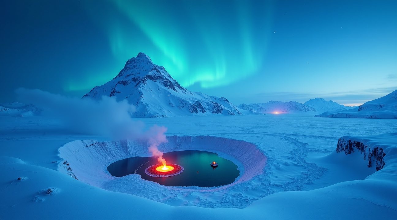
Antarctica houses two remarkable active volcanoes that distinguish themselves not just within the continent but across the entire planet. Mount Erebus towers at 3,794 meters above sea level, claiming the title of the southernmost active volcano on Earth. What makes this giant truly exceptional is its persistent lava lake—a rare phenomenon found in only a handful of locations worldwide.
The rare footage of such volcanic features captivates scientists and researchers who monitor these extreme environments. Mount Erebus maintains its lava lake year-round, providing researchers with an unprecedented opportunity to study volcanic processes in one of the most isolated locations on the planet.
Deception Island’s Explosive History
Deception Island represents another fascinating example of Antarctic volcanism, functioning as a volcanic caldera that last erupted in 1970. Scientists maintain regular seismic and volcanic monitoring of this site, recognizing its potential for future activity. The island’s unique horseshoe shape results from its explosive volcanic past, creating a natural harbor that has attracted human activity for decades.
Unlike the newly discovered volcanic systems hidden beneath West Antarctica’s ice sheets, both Mount Erebus and Deception Island receive consistent scientific attention. This monitoring proves crucial for understanding Antarctic volcanism patterns and potential impacts on ice sheet stability. However, the vast majority of West Antarctica’s volcanic features remain unmonitored due to significant logistical challenges posed by the continent’s harsh conditions and remote locations.
The contrast between these monitored active volcanoes and the hidden volcanic network beneath the ice highlights the complexity of studying Antarctic geology. While Mount Erebus continues its spectacular lava lake display and Deception Island maintains its potential for future eruptions, dozens of other volcanic features remain largely mysterious. Research teams face enormous challenges accessing these remote locations, making comprehensive volcanic monitoring across Antarctica an ongoing scientific frontier that requires innovative approaches and substantial resources.
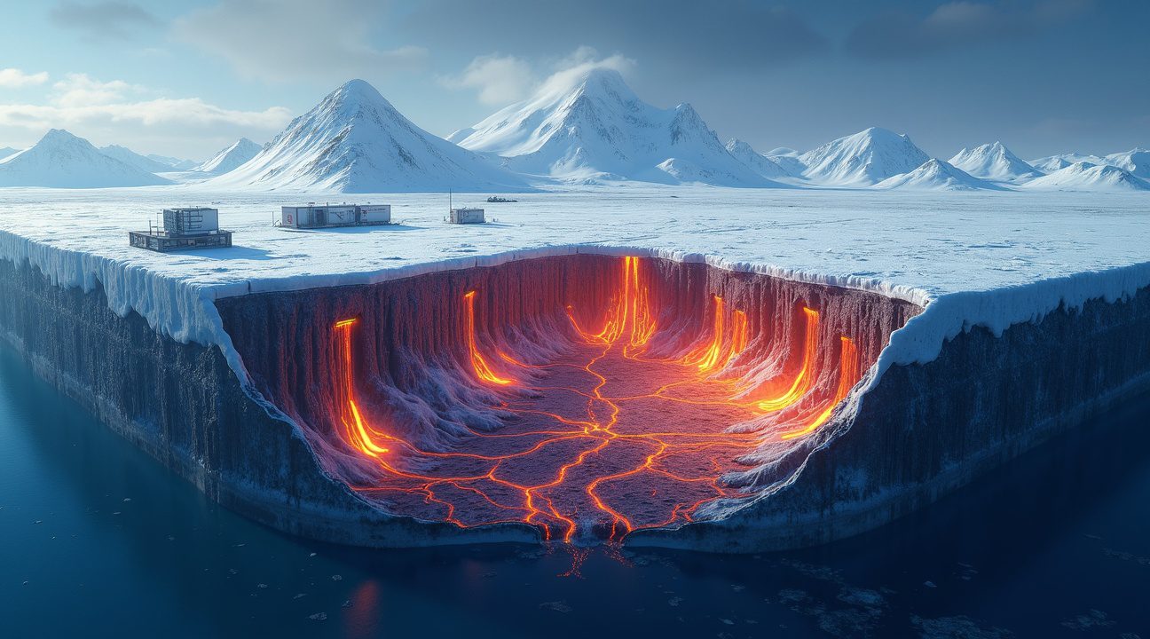
Volcanic Heat Could Accelerate Ice Loss and Sea Level Rise
I believe this hidden volcanic system beneath Antarctica poses significant concerns for global sea level projections. Heat from volcanic activity underneath the Antarctic ice sheet could contribute directly to ice thinning and accelerated melting, creating a feedback loop that scientists are only beginning to understand.
The Heat Transfer Mechanism
Volcanic heat doesn’t work alone in this process. Geothermal energy from these underground systems transfers warmth through bedrock and into the ice above, creating pockets of melt water that can lubricate ice movement and accelerate glacier flow. This heat source remains constant regardless of atmospheric temperatures, meaning volcanic activity could be undermining ice stability even during periods of surface cooling.
The process becomes particularly concerning when considering ice sheet thinning patterns. As the massive weight of ice decreases, it reduces pressure on the volcanic systems below. This phenomenon, known as post-glacial rebound, has been observed in Iceland where retreating glaciers led to increased volcanic activity. The same mechanism could theoretically apply to Antarctica’s volcanic systems.
Potential Eruption Scenarios and Ice Sheet Destabilization
Scientists worry about what happens when reduced glacial pressure allows magma reserves to become more active. The weight of Antarctica’s ice sheet currently acts like a massive lid, suppressing volcanic activity through immense pressure. However, as climate change continues to thin this ice cover, the decreasing pressure could theoretically uncork these magma reserves.
Several factors make this scenario particularly troubling for global sea levels:
- Direct melting from volcanic heat could create massive underwater lakes beneath the ice
- Eruptions could fracture ice sheets from below, creating pathways for rapid ice loss
- Volcanic ash and debris could darken ice surfaces, increasing heat absorption
- Steam and gas emissions could create cavities that weaken ice structure
- Hot water discharge could accelerate coastal ice shelf collapse
The glaciation feedback loop amplifies these concerns significantly. As ice melts and pressure decreases, volcanic activity could increase, leading to more melting and further pressure reduction. This self-reinforcing cycle could push sea level rise beyond current projections, which typically don’t account for increased volcanic activity.
Recent research into similar systems provides sobering context. Studies of subglacial volcanic activity in other regions show that even minor increases in geothermal heat can dramatically accelerate ice loss rates. Antarctica’s volcanic system, being one of the largest on Earth, could potentially dwarf these effects.
The timing presents additional challenges for climate scientists. While NASA puts up trials for massive slingshot project to study distant phenomena, monitoring volcanic activity beneath miles of ice remains technically demanding. Current satellite technology can detect surface temperature changes and ice movement patterns, but predicting volcanic eruptions under such conditions proves extremely difficult.
Researchers emphasize that magma pressure dynamics underneath ice sheets operate on geological timescales that don’t always align with rapid climate change. However, the combination of warming temperatures above and volcanic heat below creates unprecedented conditions that could accelerate both ice loss and volcanic activity simultaneously.
The implications extend far beyond Antarctica itself. Coastal cities worldwide base infrastructure planning on sea level rise projections that assume relatively stable geological conditions. If Antarctic volcanic systems become more active due to ice sheet thinning, these projections could underestimate future flooding risks by significant margins.
Understanding this volcanic system becomes crucial for refining climate models and sea level predictions. The discovery that potentially home to undiscovered species is a massive sinkhole with an ancient forest inside demonstrates how much remains unknown about our planet’s hidden geological features. Antarctica’s volcanic system represents a similar frontier where new discoveries could reshape our understanding of global climate dynamics.
Current ice loss rates already exceed many previous projections, and volcanic heat could explain some of this acceleration. Scientists continue investigating whether geothermal activity has been contributing to observed changes in Antarctic ice sheet behavior, particularly in regions where surface temperature alone doesn’t account for measured melting rates.
Revolutionary Discovery Transforms Antarctic Science
The identification of a massive volcanic province beneath Antarctica’s ice sheet has fundamentally altered our understanding of the continent’s geological architecture. This discovery reveals that Antarctica harbors one of Earth’s most extensive volcanic systems, forcing scientists to reconsider everything they thought they knew about the region’s subsurface structure and its influence on global processes.
Redefining Antarctic Geology and Rift Systems
The newly discovered volcanic network stretches across vast areas of West Antarctica, creating a complex system of interconnected volcanic centers that rivals some of the world’s most prominent geological features. I find it remarkable how this finding challenges previous assumptions about Antarctic geology, particularly regarding the distribution and scale of volcanic activity beneath the ice. The volcanic province appears to be linked to the West Antarctic Rift System, one of the most significant geological structures on the continent. This connection suggests that Antarctic rift systems play a far more active role in shaping the continent’s geology than previously understood. The sheer scale of this volcanic network indicates that Antarctica isn’t the geologically quiet continent scientists once believed it to be.
Implications for Ice Dynamics and Climate Research
This volcanic system’s potential impact on ice sheet behavior introduces critical new variables into climate change models. The discovery suggests that geothermal heat from these volcanic sources could significantly influence ice sheet stability and movement patterns. Heat generated by volcanic activity beneath the ice creates complex interactions that may accelerate ice melt in certain regions while affecting ice flow dynamics across broader areas.
The breakthrough also demonstrates how technological innovations in remote sensing continue to unveil hidden aspects of our planet. Advanced radar and seismic techniques made this discovery possible, proving that even well-studied regions like Antarctica still hold major secrets. These technologies allow researchers to peer through miles of ice and detect geological features that remained hidden for millennia.
Scientists now face exciting new research opportunities as they investigate how volcanism influences regional climate patterns and ice sheet behavior. The relationship between volcanic heat sources and ice dynamics could help explain some previously puzzling observations about Antarctic ice movement and melting patterns. This discovery opens doors to understanding how geological processes and climate systems interact in ways that weren’t apparent before. The research also highlights how concealed features beneath ice sheets continue to surprise the scientific community, demonstrating that our planet still holds many undiscovered secrets waiting to be revealed through advancing technology and persistent scientific inquiry.
Global Comparison Reveals Antarctica’s Volcanic Supremacy
Antarctica’s discovery of 138 identified volcanoes beneath its ice sheets has completely reshaped our understanding of global volcanic distribution. This staggering count places the continent at the forefront of Earth’s most extensive volcanic systems, surpassing previously recognized hotspots across the planet.
Density Comparisons Across Major Volcanic Regions
The West Antarctic volcanic range now claims the title of Earth’s densest volcanic concentration, overtaking the East African Rift system that previously held this distinction. While the East African Rift stretches across thousands of kilometers and contains numerous volcanic features, Antarctica’s subglacial system packs an extraordinary number of volcanoes into a relatively compact area beneath the ice.
The comparison becomes even more striking when examining other major geological formations. The Himalayan region, despite its massive scale and dramatic topography, contains remarkably few volcanoes due to its formation through tectonic uplift rather than volcanic activity. This fundamental difference in geological origin explains why one of Earth’s most prominent mountain ranges can’t compete with Antarctica’s hidden volcanic supremacy.
Scientists have documented that Antarctica’s volcanic system represents both the largest count and highest concentration of volcanoes discovered in any single region. The dense concentration beneath the ice creates a unique geological environment where volcanic activity interacts directly with massive ice sheets, potentially influencing global climate patterns in ways researchers are still investigating.
Understanding Earth’s Crust Dynamics
The discovery reveals fascinating insights about how different regions of Earth’s crust respond to geological forces. While traditional tectonic rifts like those in East Africa create volcanic activity through crustal spreading, Antarctica’s system operates under entirely different conditions. The massive weight of ice sheets above these volcanoes creates pressure dynamics unlike anywhere else on the planet.
Research indicates that this volcanic range extends far beyond what initial surveys suggested. Each newly identified volcano adds to our understanding of how volcanic systems can remain hidden beneath ice for millennia while potentially maintaining active or semi-active states. The implications extend beyond simple counting, as these volcanoes may play crucial roles in ice sheet stability and movement.
Recent studies comparing global volcanic distributions show that Antarctica’s system represents approximately 25% more volcanoes than the entire East African Rift system, despite occupying a smaller total area. This concentration makes it not just the largest volcanic range by count, but also the most densely packed major volcanic system known to science.
The geological processes that created this extensive volcanic network differ significantly from those found in other major volcanic regions. Unlike the complex ocean dynamics that influence surface geological features, Antarctica’s volcanoes formed through a combination of tectonic rifting and unique ice-related geological pressures.
Understanding this volcanic supremacy helps scientists better predict how similar systems might exist in other ice-covered regions of Earth or even on other planets. The discovery challenges previous assumptions about where the most significant volcanic activity occurs and demonstrates that some of Earth’s most remarkable geological features remain hidden beneath ice sheets.
The volcanic range’s sheer scale suggests that Antarctica plays a much more active role in global geological processes than previously understood. With ongoing research revealing additional volcanoes regularly, the final count may exceed current estimates significantly, further cementing Antarctica’s position as home to the planet’s most extensive volcanic system.

Sources:
Aurora Expeditions – “Antarctica Volcanoes”
Science News Explores – “Giant Volcanoes Lurk Beneath Antarctic Ice”
Volcano Foundation – “World’s Largest Volcanic Region Discovered Antarctica”
Geology by Jeff
Live Science – “Antarctica Volcanoes Eruption”